Our house was sold. Most of our possessions that wouldn’t fit on the boat were either sold or given away. This was our first big step into the next chapter of our lives. We were excited and apprehensive at the same time. Excited to be going and apprehensive because it was late fall, and we didn’t know what weather we would encounter on the trip. We were ready and we knew the boat was sturdy and strong, so on the morning of Tuesday, October 27th, 2020, at 6:15 am, we pulled in the dock lines and shoved off from McCuddy’s Landing Marina in Scappoose, OR.
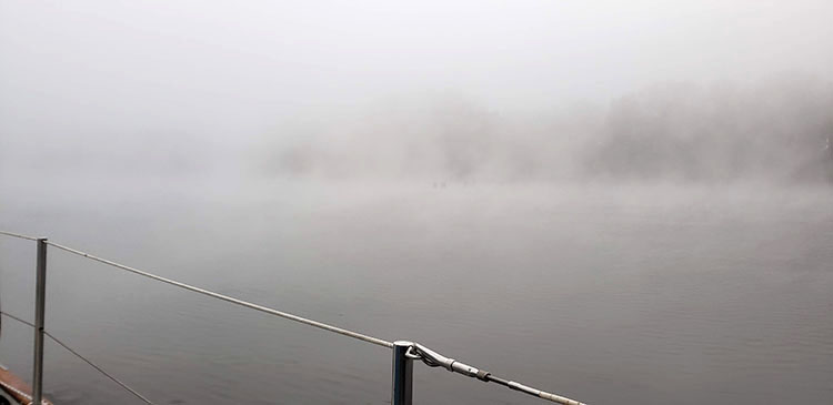
We were greeted by thick fog as we motored down the channel toward the Columbia River, with Tongue Point as our first stop. We’d made the trip down the channel to St. Helens many times, so even in the fog, it was an uneventful passage with our trusty Raymarine chart plotter.
The fog cleared by late morning and we enjoyed an easy passage down the Columbia River by motor to Tongue Point. We anchored off Mott Island just to the east of Tongue point in about 20ft of water around 6 pm as it was getting dark. We made dinner and went to bed, with the plans to rise around 6 am and be off the hook by 8 am to cross the Columbia Bar by noon.
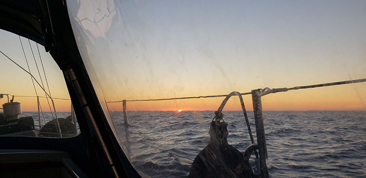
The next morning, Wednesday, October 28th, was again a foggy morning. We rose at 6 am, ate breakfast, and were off around 8 am, as we had planned. The fog was thick but became even thicker as we continued toward the bar. I am glad we have AIS, as I could “see” every large ship that was anchored or in transit on the river. We had the radar on for those boats that were not using AIS. We were hailed once by an incoming ship to establish our intentions. We agreed to pass port-to-port with our boat staying on the Washington side of the river. There were only a couple of other ships coming in, but they were far enough off that we had no contact with them. The bar crossing was uneventful, and we crossed it near high tide around noon. The fog was lifting, and we could see it was turning into a beautiful day. We even had decent wind.
We decided before the trip to go as far as we could go toward San Diego as long as the weather held. We have a PredictWind account and were monitoring weather and wave conditions in real time while we were close enough to the shore to have a cellular signal. It appeared like we could make it to Eureka, California with good weather, so that was our current plan.
The wind was steady the first afternoon and we sailed using our Hydrovane wind vane to steer. At some points, we were beam reaching around 5-6 knots. When our speed dropped to 3 knots a few times we switched to motor sailing just to keep our speed up. The seas were relatively light with only the pesky NW swell causing us to roll from time to time.
As it got dark the wind became very light. We had dropped the sails and were motoring around 5 knots at around 2000 rpm. Since we had a new engine, we were varying the speed, as the manual stated that it was good to vary the speed while breaking in the engine. So, we varied the RPMs from about 1500 to 2200 regularly, stopping at 2000rpm in the middle for a while. We weren’t in a hurry, as it appeared we had a good weather window to reach Eureka.
As night approached, we hadn’t decided how to handle taking shifts. Since my wife, Lynette, doesn’t usually fall asleep until after midnight, she opted to take the first shift from about 7 pm to midnight. She made it to 11 pm and woke me as she was having difficulty seeing ahead and didn’t want to run into anything, so I took over and made it until about 6 am when I woke Lynette to take over.
Thursday, October 29th, was uneventful. Some sailing, some motoring depending on the wind. We were about 15 miles offshore and doing reasonably well. Neither of us was sick, but we still didn’t have our sea legs, so were a bit out of sorts. We ate light and watched the miles slowly pass by. Every once in a while, a boat would show up on the AIS, but for the most part, we were alone and enjoying good weather. As night fell, I took the first shift and Lynette took the second from 11 pm to about 3 am. I was still doing the brunt of the watches but was ok with that as I wanted to ease Lynette into taking the watch at night. She did great and I got some sleep.
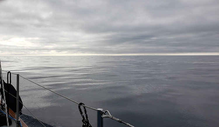
Friday, October 30th, started with some decent wind and we broad-reached for quite a while. By midday, the wind was gone, and we were becalmed. The seas were so glassy that I decided to stop to change the transmission oil and fill the diesel tank from our two 5-gallon jerry cans. After those tasks were finished, we motored until late afternoon when the wind picked up. That afternoon until early evening was the best sailing we had done on this trip. We were on a very consistent broad reach that netted us 6-7 knots.
Around 7 pm, I noticed we were starting to surf down the waves as our speed began to increase with the increase in wind speed, which was now between 15 and 20 knots. I realized I had too much sail up, so tried to furl the sails while heading downwind. I got the headsail furled but couldn’t budge the main as it was carrying too much wind. I had already started the engine, so motored around to face the wind. I was then able to furl the main and using the engine, ran bare poles into the wind, which was now gusting over 30 knots. The seas were confused, and we were being bounced around like a cork. Every time I am in those conditions I get sick, and like clockwork, I got sick. I was using the engine to help hold us at about 60º off the wind in a heave-to position. For some reason I couldn’t hold us in that position without using the engine, so kept it going.
The conditions continued to deteriorate, and I continued to be very sick. It was all I could do to keep the boat heading at 60º to the wind. I had no fear we were in danger as I knew the boat was strong. I was more frustrated that I was so sick and felt helpless and weak from vomiting. Around 2 or 3 am, the engine quit suddenly. I had no idea why but decided to call the USCG for a rescue, as I had no idea if the storm was going to blow out or get worse over the next few hours. The USCG mustered a boat crew and headed out to tow us in. It took about 2.5 hours for them to reach us. Along the way, they were in touch with us every half hour to get our position and ask how we were doing. During one of the first conversations I had with the skipper, she said that about 6nm to the east of us the conditions were much calmer. Go figure, only 6nm too far offshore.
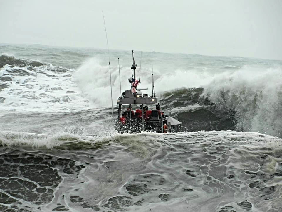
When the USCG arrived, they offered to throw us a tow line. Neither Lynette nor I felt able or strong enough to go to the bow to retrieve the line, so plan B was to land one of their crew on our deck in the rough conditions. They were successful at landing a crew member on deck after about 3 or 4 tries. Unfortunately, not without damage to our bow stem fitting and anchor roller. With us in tow, it took about 3 hours to tow us to Brookings, Oregon.
We arrived in Brookings on Saturday, October 30th, and discovered that two of our dock lines had gone overboard and gotten tangled in the prop. We have a line cutter on the prop, so the lines were cut and not tangled in the prop, but the zincs on the prop shaft must have caught one of the lines and jammed the line between the prop shaft and the hull at the shaft log. What came next is a topic for another article, as we were on the hard in Brookings for about 2 weeks getting repairs done.
Fast forward to Thursday, November 19th, when we were finally able to leave Brookings and continue our journey to San Diego. This was our first weather window after splashing the boat on Monday, November 16th. It was an iffy window, but we were both getting anxious to leave. Winter was coming and the weather windows that I had been tracking were becoming fewer and fewer. The saying in Brookings is if you haven’t left by Halloween, you aren’t going to go. It was November 19th, so to say the least, we were anxious.
The previous two days had been windy with rain, so the seas were still a bit big. I called the USCG around 7 am to check on the bar conditions as there was a small craft warning for the bar, but it wasn’t closed. They said 30ft and under were restricted. I told them we were 40ft, and they said to stay in the middle of the channel and be careful.
The Brookings marketing material states that the Brookings bar is the least dangerous bar on the coast. Well, that morning it was showing its teeth. The crossing was very rough with rather large waves and deep troughs. Lynette and I commented to each other that these bar conditions were worse than any crossing we had done at the Columbia Bar. We’d crossed that bar at least half a dozen times with no incidents. It was an interesting experience for our first day out following our “adventure” two weeks prior. To say we were apprehensive was an understatement. We had been wishing for a bit better conditions but felt we had to push on to keep within the current weather window (the weather looked nasty coming down from the north).

Our goal was to see how our stomachs felt and take it easy to Eureka. We made it to Eureka in great time motor sailing and found that due to the high seas the bar was closed. It was mid-day on Friday, November 20th, so we hove to for a few hours to see if the bar would open. It didn’t, so we pushed on. We chose to anchor overnight at Shelter Cove and got there just as night was setting in. Having never been to Shelter Cove, we tiptoed past the buoys and found a spot in about 30ft of water to anchor. I was trying to get us tucked up into the cove as far as I could to avoid the NW swell. We didn’t get far enough in, so consequently, we had a night of constant rolling. Ugh, I almost got seasick again, as the boat would roll from side to side quite violently and then stop maybe for 3 to 5 minutes, then it would start again, over and over again, all night long. We couldn’t wait for the morning so we could get underway.
As soon as the day broke on Saturday, November 21st, we started the engine and weighed anchor. Because the bow roller had been damaged, I had quite a bit of difficulty retrieving the anchor. The chain would hang in the gypsy due to the extra drag the roller was causing. It took about half an hour to finish weighing the anchor. That was the last time we anchored during our voyage, as I didn’t want to repeat that ordeal.
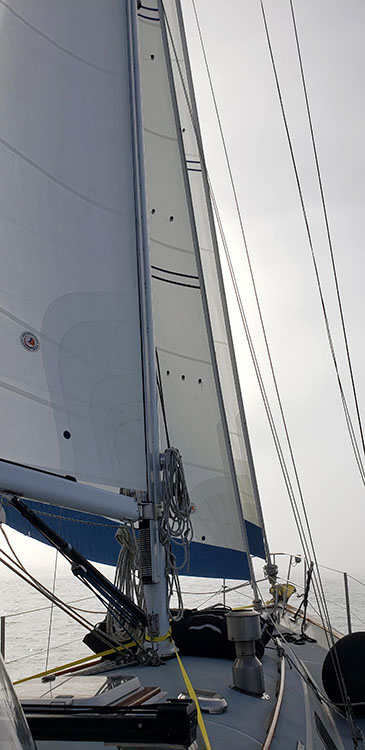
We checked the weather and it looked good, so we headed south not knowing where our next stop would be. Again, light winds, so mostly motoring or motor sailing. With the stem fitting damages I didn’t want to put undue strain on the forestay, so didn’t use the headsail for the rest of the journey. Luckily, we are cutter rigged, so we deployed the staysail as an alternative. It’s smaller, but still quite functional.
While on the route south Lynette spotted two whale spouts off the starboard bow about 50 yards. One was larger than the other, so we assumed a mother and calf. A few minutes later we saw a very long pectoral fin come out of the water, signifying these were humpback whales. That was our only brief encounter with whales, but we felt fortunate to have not missed the encounter.

Next stop, Bodega Bay. The weather was starting to collapse a bit, as we closed in on Bodega bay, so we opted to tuck in there for a few days to let the blow go by. We arrived mid-day on Sunday, November 22nd. Spuds Marina is tucked in rather far from the entrance to the bay, so there was a bit of negotiating crab pots and channel markers to get there. We took on fuel and were assigned an end tie for the night. After settling in, we checked the weather and decided it was necessary to stay for two nights, so paid for a second night at the dock.
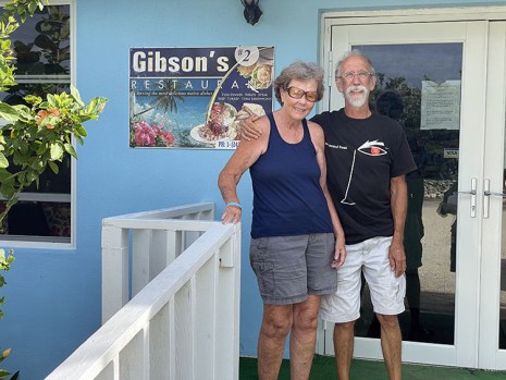
Bodega Bay is a quaint little town with a history of where the Alfred Hitchcock movie, The Birds, was filmed. Unfortunately, without transportation (no Uber, or Lyft and only a bus once a day) we were stuck wandering around the docks. We did laundry and ate a late lunch at a fantastic small restaurant across the street from the marina. We had the best clam chowder we had ever eaten.

The next day we opted to walk into town to get groceries as we were running low on supplies. We got local advice as to which store was better (there were only two) and headed out for the 1.2-mile walk into town. It was a nice walk that took us past the café that was used in the movie, so took a picture of the sign. We didn’t stop as there were lots of people there being tourists. With groceries in hand, we walked the 1.2 miles back to the boat and settled in for the night.
Early on Tuesday, November 24th, we left the docks and headed to Monterey. Again, an uneventful motor sail down the coast. On approach to Monterey on Wednesday, November 25th, I called my nephew to let him know we were going to be stopping in Monterey. He lives in Hollister, which is about 45 minutes from Monterey. He offered to put us up in a hotel and have us come to Thanksgiving dinner the next day, so we checked the weather and saw that a storm was going to blow in that wouldn’t allow us to leave until Friday, so we accepted his offer. This was to be a great diversion from our travels and an opportunity to spend some time with family. It was a wonderful Thanksgiving.
We fueled up and left Monterey on Friday, November 27th at noon. The seas were calm, and the winds were very light, so we spent the day motoring south. We still were anxious to get as far south as possible before the next storm rolled in, so continued to motor at about 5 to 5.5 knots. Our immediate goal was to get south of Point Conception, where it seemed the weather was more stable.
Our original plan was to stop at Morro Bay to see Lynette’s cousin and family, but after reading about the approach, decided to forgo stopping and kept heading south. We weren’t tired and both of us were feeling pretty good. Our motto was to keep heading south if the seas and winds were favorable. So, we did just that. Also, in our original plans, we were going to anchor at one of the Channel Islands as an overnight, but due to the anchor roller damage and the difficulty we had weighing anchor at Shelter Cove, we decided not to. We didn’t even discuss pulling into Santa Barbara as we didn’t want to waste the time. The weather looked good, and it seemed like we could make it to San Diego without rough seas or heavy winds, so our goal changed to continue to San Diego non-stop.
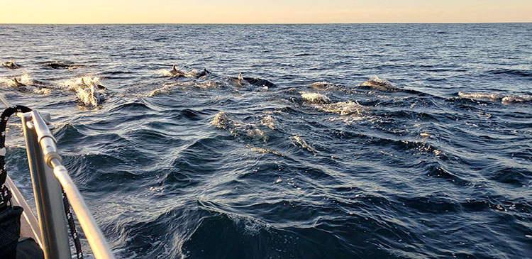
This last passage was so uneventful that it was almost boring. I decided to accidentally spice it up by taking the inside passage past the Channel Islands where I thought we would be shadowed from the NW swell. After committing to the inside we did lose the swell but didn’t plan on so much large ship traffic. Lynette didn’t feel comfortable taking a shift with so much traffic, so I managed to do an all-nighter staying out of the way of the big ships. The shipping traffic separator ran pretty close to the islands, so we hugged the islands all night long. We were just passing between Santa Cruz and Anacapa Islands as day broke on Sunday, November 29th. After the Channel Islands were at our stern I was greeted by a shoal of porpoises. They didn’t hang around long, but they did put a bright spot on my morning. Lynette missed them as she was still sleeping.
The wind came up for a bit and we sailed at 4-5 knots for a while until our speed dropped to around 3 knots and we went back to motor sailing. Late in the afternoon another shoal of porpoises came and played in our bow wave for quite some time. I decided to get some photos and do a movie but found after I got back to the cockpit that I had mistakenly thought the red light on the phone was indicating I was recording, when in fact it was indicating the opposite. The only movie footage I got was of me walking back to the cockpit. Oh well. I still had some images of them playing in the bow wave.

As we approached Catalina Island that evening, I decided to take the outside route as I didn’t want a repeat of the traffic we had passing the Channel Islands. We reached Catalina at sunset, with the full moon rising over the island. It was a picture moment. Lynette took the first watch and I slept. When she woke me around midnight we were almost to the end of the island. Once clear of Catalina I shifted course and headed directly toward Point Loma at the entrance to San Diego bay. All the while just motoring as there was next to no wind.


We entered San Diego harbor around 11 am on Monday, November 30th, and called the marina in Chula Vista to let them know we were getting close. By that time, we were motoring on fumes, having not fueled since Monterey. Except for the brief sail on Sunday, we motored the entire distance. Our new Beta 43 engine did us proud. We averaged 0.6 to 0.8 gallons per hour. I called the marina and they said they didn’t have a fuel dock, so we backtracked a mile to the closest fuel dock on Harbor Island and filled the tank and jerry cans.
We arrived and docked without mishap around 3 pm. The journey was finally over. It had seemed like a whirlwind trip bypassing all the interesting places to stop, but after losing 2 weeks in Brookings, we felt we needed to get it over before the weather got worse. Even though we lost 2 weeks and had to spend the money to stay in a hotel and fix the boat, we were able to put a positive spin on the incident. We met some great people who helped us while we were there, and if we hadn’t been delayed, we wouldn’t have had the opportunity for the fantastic family Thanksgiving dinner at my nephew’s home. What a great voyage!

We’re here in San Diego with family nearby. We did Christmas with Lynette’s daughters and have been enjoying the warmer, sunnier weather. Boat projects and a sail to Catalina are in our future for this spring. After that, who knows? We had originally planned to do the 2020 Bajahaha, but it was canceled due to the pandemic. Maybe later this year things will have settled down and we can continue our journey south. Here’s to a better 2021. Happy New Year!
